Critical Resources (ASX: CRR) has made positive progress on a number of fronts in preparation for a full 2024 work program at its Mavis Lake lithium project in Ontario, Canada.
The company is now on target to enter a busy 2024 on the back of its work on a full suite of baseline studies and exploration activities which have been refined in recent months.
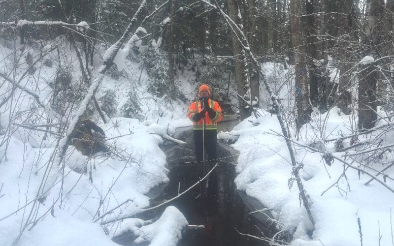
Critical Resources has told shareholders that its environmental field teams have made good progress with their monitoring and assessment programs to support the permitting of a potential future mining operation at Mavis Lake.
Baseline study work
A recent focus has been on baseline work including hydrology studies along with wetland and terrestrial studies.
Critical Resources is confident a number of study areas that require two years of baseline data are on target for completion in 2024.
As part of its desktop archaeology studies, the company is preparing to review and obtain feedback from First Nations communities in Q1 2024, followed by field programs to confirm any points of interest and/or significance identified in the stage one assessment.
The company will also continue ecological classification of vegetation communities, studies of breeding birds and an evaluation of potentially significant wildlife habitat throughout 2024 to build on data captured during 2023.
Similar efforts will be made for fisheries monitoring and baseline data capture.
Geochemistry and hydrogeology studies
Geochemistry assessment is on target to be completed in early 2024, with initial results to be used to support mine planning and waste rock management assessments.
An initial hydrogeology study will also be undertaken to establish baseline conditions and allow for trend assessment of groundwater conditions, with initial works scheduled to commence in Q1 2024.
Managing director Alex Cheeseman said the outcome of the hydrogeology studies is particularly important as it will provide key information for both mine planning and process water requirements.
Important part of the process
“These important monitoring and baseline study workstreams are essential in advancing the Mavis Lake project. We are getting on the front foot with a wide range of activities for environmental assessment, permitting and community engagement,” Mr Cheeseman said.
“We made the strategic decision to advance this portion of works to de-risk the project schedule and allow for mine/operational design activities to incorporate the findings.”
“We are pleased to see continued and meaningful engagement with our First Nations partners. Their input and counsel for archaeological studies is essential to ensure that we advance the project in a manner that is conscious and respectful to the customs and traditions of [these] communities.”
Exploration work also progressing
In early November, Critical Resources provided an update on numerous exploration workstreams being conducted over the northern prospects at Mavis Lake.
The company revealed it is using a strategic plan to combine and layer multiple exploration techniques and outputs – including geological mapping, litho-geochemical sampling as well as light detection and ranging (LiDAR) and airborne-magnetometry surveys – to help to refine higher-confidence drill targets around the already known large-scale spodumene-bearing outcrops.
The results from those programs will be used to produce geological, geochemical and geophysical overlays, which in combination with previous field work programs will help determine high priority, high-confidence drill targets.
High-tech exploration
A major focus of recent exploration work was the LiDAR survey completed across the Gullwing and Tot property at Mavis Lake.
The Gullwing-Tot claims are contiguous with main zone claims and form the broader Mavis Lake project area, covering approximately 23,000 hectares.
The LiDAR survey was undertaken to provide highly accurate elevation models of the local terrain.
A high-resolution orthophoto (a photograph scaled like a map) was also captured to provide the most recent aerial imagery of the Gullwing and Tot Property.
The elevation model is required for future drill hole planning due to the variable topography in the areas.
Other surveys
A mobile metal ion survey was also carried out to help identify lithium-caesium-tantalum pegmatite deposits, specifically those overlain by the glacial lacustrine overburden.
Critical Resources also scheduled an unmanned aerial vehicle (UAV)-magnetometry survey to be flown at low altitude across the Gullwing and Tot prospects.
High-resolution magnetic data collected from a stable and accurately positioned platform (such as a UAV) also supports the production of detailed 3D models of the magnetic sources in the earth.
Critical Resources expects the 3D products from inversion of the magnetic survey data to provide excellent tools for drill-targeting magnetic sources, as well as non-magnetic bodies that may lie above or below them in the stratigraphic sequence.
In May 2023, the company released a joint ore reserves committee 2012-compliant, maiden mineral resource estimate of 8 million tonnes at 1.07% lithium oxide and the continuing exploration activities are aimed at increasing the resource size.
